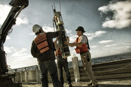
All robots are present and accounted for. The two Carbon Flux Explorers launched yesterday and the day before were recovered today, including CFE-Cal 2 with its experimental sample collection system.

Recovery of the Carbon Flux Explorer-Cal. (Photo: Sarah Yang)
When the latter robot was inspected on deck, the researchers were initially disappointed to see that a tube meant to direct particles into the tray had become disconnected. If the separation occurred soon after its deployment, there would be no samples to show for its time at sea.
Happily, the researchers did find samples in the collection bottles, and they could tell that the flushing system was working, which would not be true if the tube had come apart. It seems likely that the part was disconnected as the Carbon Flux Explorer was brought on deck.
And so our time at the Santa Cruz Basin ended. As soon as the second robotic float was brought on board, the ship began its journey to the second station on this expedition, a spot on the outer edge of the California Current. This is an ocean current that flows from the north Pacific south along the west coast of North America, completing the North Pacific Gyre circulation.
The samples taken from the Santa Cruz Basin are expected to reflect the biology typical of productive, near-shore waters.
In contrast, the next stop will be far less biologically productive. It is located just outside the California Current, about 350 miles offshore, west of San Luis Obispo. Jim Bishop chose the location because computer simulation of offshore waters near California indicate that it is an oligotrophic region of the ocean.
“We’re truly going to Oceana Incognito from the point of view of satellite imaging of the ocean surface,” said Bishop. “When clouds are in the way, as they have been for the past month, neither ocean color sensors – which detect phytoplankton – nor infrared sensors that measure sea surface temperature will work. We’ve been looking at data and there has not been one image of the area we would like to go to because of the clouds. Hopefully the models of the ocean currents are right.”
We are expected to arrive at the next location late Friday evening.
In the meantime, I would like to thank Mark Booher, the chief engineer of the Oceanus, for sacrificing his drone – or at least his drone’s rotors – in the name of science. While hovering near the deck in preparation for getting aerial shots of the launch and recovery of the Carbon Flux Explorer, the drone had an unfortunate run-in with a deck crane.
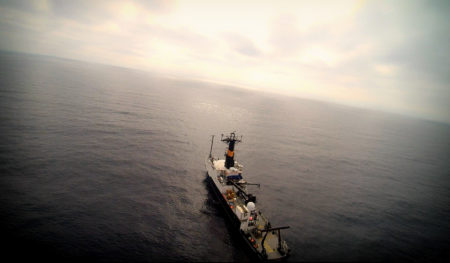
Luckily, we did get a nice video from above the Oceanus that I plan to post after I return to San Francisco (and normal wi-fi access). Below is a teaser.

The Oceanus at sea via aerial drone. (Credit: Mark Booher)
Be sure to return to this site once the voyage ends (and more bandwidth is available) for more photos — and videos — from the research effort.
